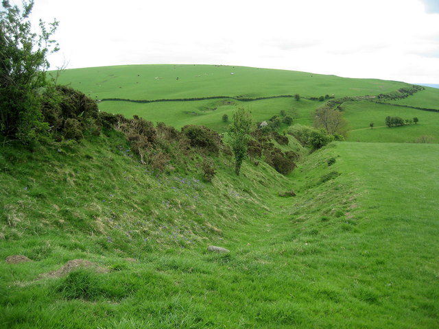
Offa’s Dyke is a massive linear earthwork, roughly following some of the current border between England and Wales. In places, it is up to 65 feet (20 m) wide (including its surrounding ditch) and 8 feet (2.5 m) high. In the 8th century it formed some kind of delineation between the Anglian kingdom of Mercia and the Welsh kingdom of Powys. It has been the subject of considerable research in recent years, dispelling many of the earlier understandings.
Overview
It is still generally accepted that much of the earthwork can be attributed to Offa, King of Mercia from 757 to 796. Its structure is not that of a mutual boundary between the Mercians on the one side and the people of Powys on the other. The earthwork was dug with the displaced soil piled into a bank on the Mercian (eastern) side. Where the earthwork encounters hills, it goes to the west of them, constantly providing an open view into Wales. The implication must be that this was an earthwork built by Mercia as a defence against attacks or raids from Powys.
Offa was one of the great rulers of Anglo-Saxon times, though his reign is often overlooked owing to a limitation in source material. That he was able to raise a workforce and resources sufficient enough to construct such an earthwork as Offa”s Dyke is testament to his power. It is likely that some form of ”service” system was used to construct the Dyke, with people from certain areas of land being required to build a certain length of the wall. This can be seen alongside the normal services that had to be offered to kings. A document exists from around this period known as Tribal Hidage, which makes some assessment of how land was distributed in the 8th century. Though there is little evidence to associate the document with the Dyke, it is possible that both the Dyke and the document stem from a common practice.
Historical Evidence
The late 9th- and early 10th-century writer Asser informed us that ”there was in Mercia in fairly recent time a certain vigorous king called Offa, who terrified all the neighbouring kings and provinces around him, and who had a great dyke built between Wales and Mercia from sea to sea’ (Asser, Life of Alfred, 14). The last four words are vital: historians and archaeologists coming to the Dyke have had Asser in their hand, looking for an earthwork ”from sea to sea”. Sir Cyril Fox completed the first major survey of the Dyke (Fox 1955), and, in agreement with Asser, saw the Dyke as running from the estuary of the River Dee in the north to the River Wye in the south (approximately 150 miles, or 240 km). It was understood by him that the dyke was not continuous, being built only in areas where natural barriers did not already exist.
Frank Stenton, the Anglo-Saxon historian of his day, accepted Fox’s description, and wrote the introduction to Fox’s account of the Dyke. Though Fox’s work has now been to some extent revised, it remains a vital record of how areas of the Dyke, now destroyed, existed in 1931.
Modern Scholarship
Frank Noble did much to challenge Fox’s legacy. His greatest contribution to Offa’s Dyke was to stir up new academic interest. His MPhil thesis, “Offa”s Dyke Reviewed”, raised several questions regarding the Dyke. Noble postulated that the gaps in the Dyke were not due to natural features, but that instead a ”ridden boundary” operated, perhaps incorporating palisades that left no archaeological trace. Noble also was vital in establishing the Offa’s Dyke Association, which maintains the Offa’s Dyke Path, a long distance footpath which mostly follows the route of the dyke, which is one of the designated British National Trails.
Ongoing research and archaeology on Offa’s Dyke has been undertaken for many years by the Extra-Mural department of the University of Manchester. Most recently David Hill and Margaret Worthington have undertaken considerable research on the Dyke. Their work, though far from finished, has demonstrated that there is little evidence for the Dyke stretching from sea to sea. Rather, they claim that it is a shorter structure stretching from Rushock Hill north of the Herefordshire Plain to Llanfynydd, near Mold, Flintshire, some 64 miles (103 km). According to Hill and Worthington, dykes in the far north and south may date differently, and though they may be connected with Offa’s Dyke, there is as yet no compelling evidence behind this. However, not all experts accept this view.
The Offa’s Dyke Centre
The Offa’s Dyke Centre is a purpose-built information centre based in the town of Knighton, situated on Offa’s Dyke on the border between England (Shropshire) and Wales (Powys). Some of the best remains of the 8th century earthworks can be seen just a two-minute walk from the centre.
Useful Links
Offa’s Dyke Association Website


