
Washington D.C., United States
Broad avenues fan out from the Capitol, white monuments line the National Mall, and in spring the cherry trees around the Tidal Basin come into bloom. Washington, D.C., formally the District of Columbia and commonly called Washington, the District, or simply D.C., is the capital of the United States, founded on 16 July 1790.
The City of Washington was originally a separate municipality within the Territory of Columbia, until an act of Congress in 1871 merged the City and the Territory into a single entity called the District of Columbia. That is why the city, while legally named the District of Columbia, is known as Washington, D.C. It lies on the north bank of the Potomac River and is bordered by Virginia across the water and by Maryland on its remaining sides.
The 2020 census counted 689,545 residents, and the Census Bureau's 2025 estimate is about 693,645. Because of commuters from the surrounding suburbs, the population rises to over one million during the workweek. The Washington Metropolitan Area, of which the District is a part, had about 6.47 million people in the Census Bureau's 2025 estimate and ranks as the seventh-largest metropolitan area in the country.
Article One of the United States Constitution provides for a federal district, distinct from the states, to serve as the permanent seat of the nation's government. The centres of all three branches of the federal government are located in the District, as are many of the nation's monuments and museums. Washington, D.C., hosts 173 foreign embassies as well as the headquarters of the World Bank, the International Monetary Fund (IMF), the Organization of American States (OAS), the Inter-American Development Bank, and the Pan American Health Organization (PAHO). Trade unions, lobbying groups and professional associations also have their headquarters here.
The United States Congress has supreme authority over Washington, D.C., so residents have less self-governance than residents of the states. The District has a non-voting at-large Congressional delegate, but no senators. D.C. residents could not vote in presidential elections until the ratification of the Twenty-third Amendment to the United States Constitution in 1961. If Washington, D.C. were a state, it would rank last in area (behind Rhode Island) and first in population density. At about 694,000 residents, it is larger than both Wyoming and Vermont, so it would rank third-to-last in population. It would also rank 35th in gross state product and first in percentage of African Americans, which would make it a minority-majority state.
A Capital Takes Shape
An Algonquian people known as the Nacotchtank inhabited the area around the Anacostia River where Washington now lies when the first Europeans arrived in the 17th century. Native American people had largely relocated from the area by the early 18th century. Georgetown was chartered by the Province of Maryland on the north bank of the Potomac River in 1751, and would be included within the new federal territory nearly 40 years later. The City of Alexandria, Virginia, founded in 1749, was also originally included within the District.
James Madison set out the need for a federal district on 23 January 1788 in his “Federalist No. 43”, arguing that the capital had to be distinct from the states so that it could provide for its own maintenance and safety. An attack on Congress at Philadelphia by a mob of angry soldiers, known as the Pennsylvania Mutiny of 1783, had already underlined the need for the government to see to its own security. The authority to establish a federal capital was therefore written into Article One, Section Eight, of the Constitution, which permits a “District (not exceeding ten miles square) as may, by cession of particular states, and the acceptance of Congress, become the seat of the government of the United States”. The Constitution does not, however, specify a location.
In what became known as the Compromise of 1790, Madison, Alexander Hamilton and Thomas Jefferson agreed that the federal government would assume the debts the states had carried from the Revolutionary War, on the condition that the new capital would be located in the South.
On 16 July 1790, the Residence Act provided for a new permanent capital on the Potomac River, the exact area to be selected by President Washington. As permitted by the Constitution, the initial shape of the federal district was a square, measuring 10 miles (16 km) on each side, totalling 100 square miles (260 km2). During 1791–92, Andrew Ellicott and several assistants, including Benjamin Banneker, surveyed the border of the District with both Maryland and Virginia, placing boundary stones at every mile point. Many of the stones are still standing.
A new “federal city” was then constructed on the north bank of the Potomac, to the east of the established settlement at Georgetown. On 9 September 1791, the federal city was named in honour of George Washington, and the district was named the Territory of Columbia, Columbia being a poetic name for the United States in use at that time. Congress held its first session in Washington on 17 November 1800.
The Organic Act of 1801 officially organised the District of Columbia and placed the entire federal territory, including the cities of Washington, Georgetown and Alexandria, under the exclusive control of Congress. The unincorporated territory was organised into two counties: the County of Washington on the Maryland side of the Potomac and the County of Alexandria on the Virginia side. Citizens living in the District were no longer considered residents of Maryland or Virginia, which ended their representation in Congress.
Fire, Retrocession and Civil War
On 24–25 August 1814, in a raid known as the Burning of Washington, British forces invaded the capital during the War of 1812, in retaliation for the sacking and burning of York (modern-day Toronto). The Capitol, Treasury and White House were burned and gutted. Most government buildings were quickly repaired, but the Capitol, which was then largely under construction, would not be completed until 1868.
Since 1800, the District's residents have protested their lack of voting representation in Congress. Various proposals were offered to return the ceded land to Maryland and Virginia, a process known as retrocession, but they failed to win enough support until the 1830s. By then Alexandria had gone into economic decline through neglect by Congress. It was also a major market in the American slave trade, and rumours circulated that abolitionists in Congress were attempting to end slavery in the District, an action that would have further depressed its economy.
Unhappy with Congressional authority, the people of Alexandria began in 1840 to petition for the return of that part of the District to Virginia. The state legislature complied in February 1846, partly because the return of Alexandria provided two additional pro-slavery delegates to the Virginia General Assembly. On 9 July 1846, Congress agreed to return all the District's territory on the Virginia side of the Potomac River to the Commonwealth of Virginia.
Confirming the fears of pro-slavery Alexandrians, the Compromise of 1850 outlawed the slave trade in the District, though not slavery itself. By 1860, approximately 80% of the city's African American residents were free blacks. The outbreak of the American Civil War in 1861 led to notable growth in the District's population, through the expansion of the federal government and a large influx of freed slaves. In 1862, President Abraham Lincoln signed the Compensated Emancipation Act, which ended slavery in the District of Columbia and freed about 3,100 enslaved persons, nine months before the Emancipation Proclamation. By 1870, the population had grown to nearly 132,000. Despite this growth, Washington still had dirt roads and lacked basic sanitation, and the situation was so bad that some members of Congress proposed moving the capital elsewhere.
With the Organic Act of 1871, Congress created a new government for the entire federal territory. The Act combined the City of Washington, Georgetown and Washington County into a single municipality officially named the District of Columbia. Even though the City of Washington legally ceased to exist, the name continued in use and the whole city became commonly known as Washington, D.C. The same Act appointed a Board of Public Works charged with modernising the city.
In 1873, President Grant appointed the board's most influential member, Alexander Shepherd, to the new post of governor. That year Shepherd spent $20 million on public works ($357 million in 2007), which modernised Washington but also bankrupted the city. In 1874, Congress abolished Shepherd's office in favour of direct rule. Further projects to renovate the city would not be carried out until the McMillan Plan in 1901.
Reform, Riots and Home Rule
The District's population remained relatively stable until the Great Depression of the 1930s, when President Franklin D. Roosevelt's New Deal legislation expanded the bureaucracy in Washington. World War II further increased government activity and the number of federal employees in the capital, and by 1950 the District's population had reached a peak of 802,178 residents. The Twenty-third Amendment was ratified in 1961, granting the District three votes in the Electoral College.
After the assassination of civil rights leader Dr Martin Luther King, Jr., on 4 April 1968, riots broke out in the District, primarily along the U Street, 14th Street, 7th Street and H Street corridors, centres of black residential and commercial life. The riots raged for three days, until over 13,000 federal and National Guard troops managed to quell the violence. Many stores and other buildings were burned, and rebuilding was not complete until the late 1990s.
In 1973, Congress enacted the District of Columbia Home Rule Act, providing for an elected mayor and Council for the District. In 1975, Walter Washington became the first elected and first black mayor of the District. During the later 1980s and 1990s, however, city administrations were criticised for mismanagement and waste. In 1995, Congress created the District of Columbia Financial Control Board to oversee all municipal spending and rehabilitate the city government. The District regained control over its finances in September 2001 and the oversight board's operations were suspended.
On 11 September 2001, terrorists hijacked American Airlines Flight 77 and deliberately crashed the plane into the Pentagon in nearby Arlington, Virginia. United Airlines Flight 93, destined for Washington, D.C., crashed in Pennsylvania when passengers tried to recover control of the plane from hijackers.
A Planned City
Cityscape
Washington, D.C., is a planned city. The design was largely the work of Pierre Charles L'Enfant, a French-born architect, engineer and city planner who first arrived in the colonies as a military engineer with Major General Lafayette during the American Revolutionary War. In 1791, President Washington commissioned L'Enfant to plan the layout of the new capital. L'Enfant's plan was modelled in the Baroque style, with broad avenues radiating out from rectangles and circles to provide open space and landscaping.
In March 1792, President Washington dismissed L'Enfant because of his insistence on micromanaging the planning, which had led to conflicts with the three commissioners appointed to supervise the capital's construction. Andrew Ellicott, who had worked with L'Enfant surveying the city, was then commissioned to complete the plans. Though Ellicott made revisions, including changes to some of the road patterns, L'Enfant is still credited with the overall design. The City of Washington was bounded by what is now Florida Avenue to the north, Rock Creek to the west, and the Anacostia River to the east.
By the start of the 20th century, L'Enfant's vision of a capital with open parks and grand monuments had become marred by slums and randomly placed buildings, including a railroad station on the National Mall. In 1900, Congress formed a joint committee, headed by Senator James McMillan, charged with beautifying Washington's ceremonial core. The McMillan Plan was finalised in 1901. It included the re-landscaping of the Capitol grounds and the Mall, the construction of new federal buildings and monuments, the clearing of slums, and a new citywide park system. The architects recruited by the committee kept the city's original layout, and their work is thought to be the grand completion of L'Enfant's intended design.
After the construction of the twelve-storey Cairo Apartment Building in 1899, Congress passed the Heights of Buildings Act, which declared that no building could be taller than the Capitol. The Act was amended in 1910 to restrict building height to the width of the adjoining road plus 20 feet (6.1 m). Today the skyline remains low and sprawling, in keeping with Thomas Jefferson's wish to make Washington an “American Paris”, with “low and convenient” buildings on thoroughfares that were “light and airy”. As a result, the Washington Monument remains the District's tallest structure.
The height restriction has been blamed as a primary reason why the city has limited affordable housing and traffic problems as a result of urban sprawl. To escape it, taller buildings close to downtown are often constructed across the Potomac River in Rosslyn, Virginia.
The District is divided into four quadrants of unequal area: Northwest (NW), Northeast (NE), Southeast (SE) and Southwest (SW). The axes bounding the quadrants radiate from the United States Capitol, and all road names include the quadrant abbreviation to indicate their location. In most of the city the roads are laid out in a grid, with east–west roads named with letters (for example, C Street SW) and north–south roads with numbers (for example, 4th Street NW).
The avenues radiating from the traffic circles are primarily named after states. All 50 states are represented, as well as Puerto Rico and the District itself. Pennsylvania Avenue connects the White House with the Capitol, and K Street houses the offices of many lobbying groups. Of the 173 foreign embassies in Washington, 57 are located on a section of Massachusetts Avenue informally known as Embassy Row.
Architecture
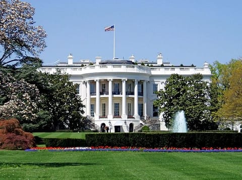
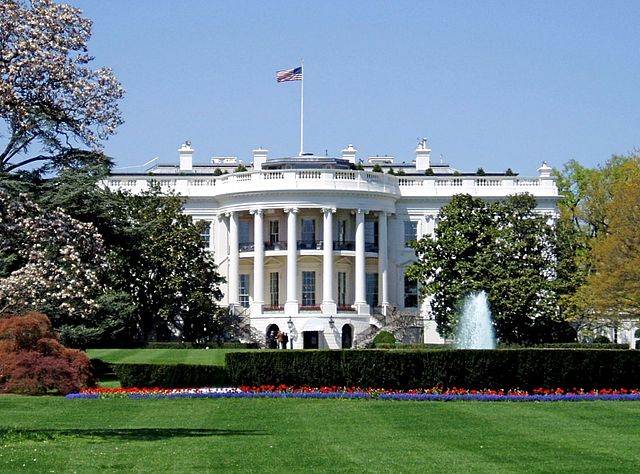
The architecture of Washington varies greatly. Six of the top 10 buildings in the American Institute of Architects' 2007 ranking of “America's Favorite Architecture” are in the District of Columbia: the White House, the Washington National Cathedral, the Thomas Jefferson Memorial, the United States Capitol, the Lincoln Memorial and the Vietnam Veterans Memorial. Neoclassical, Georgian, Gothic and modern styles are all reflected among those six structures and many other prominent buildings. Notable exceptions include buildings in the French Second Empire style, such as the Old Executive Office Building and the Library of Congress.
Outside downtown Washington, architectural styles are even more varied. Historic buildings are designed primarily in the Queen Anne, Châteauesque, Richardsonian Romanesque, Georgian revival and Beaux-Arts styles, and a variety of Victorian modes. Rowhouses are especially prominent in areas developed after the Civil War and typically follow Federalist and late Victorian designs.
Since Georgetown was established before the city of Washington, the neighbourhood features the District's oldest architecture. Georgetown's Old Stone House was built in 1765, making it the oldest standing building in the city. The majority of current homes in the neighbourhood, however, were not built until the 1870s and reflect late Victorian designs. Georgetown University, founded in 1789, is more distinct from the neighbourhood and features a mix of Romanesque and Gothic Revival architecture. The Ronald Reagan Building is the largest building in the District, with a total area of approximately 3.1 million square feet (288,000 m2).
Washington Today
Historic sites and museums
The National Museum of the American Indian opened in 2004.
The National Mall is a large, open park in the centre of the city, with the Washington Monument at its heart. Also on the Mall are the Lincoln Memorial, the National World War II Memorial at the east end of the reflecting pool, the Korean War Veterans Memorial, the Vietnam Veterans Memorial and the Albert Einstein Memorial. The National Archives houses thousands of documents important to American history, including the Declaration of Independence, the United States Constitution and the Bill of Rights.
Directly south of the National Mall, the Tidal Basin features rows of Japanese cherry blossom trees that were presented as gifts from the nation of Japan. The Franklin Delano Roosevelt Memorial, the Jefferson Memorial and the District of Columbia War Memorial are located around the Tidal Basin.
The Smithsonian Institution is an educational foundation chartered by Congress in 1846 that maintains most of the nation's official museums and galleries in Washington, D.C. The United States government partially funds the Smithsonian, which makes its collections open to the public free of charge. The most visited of its museums in 2007 was the National Museum of Natural History on the National Mall.
Other Smithsonian museums and galleries on the National Mall are the National Air and Space Museum; the National Museum of African Art; the National Museum of American History; the National Museum of the American Indian; the Sackler and Freer galleries, which both focus on Asian art and culture; the Hirshhorn Museum and Sculpture Garden; the Arts and Industries Building; the S. Dillon Ripley Center; and the Smithsonian Institution Building, also known as “The Castle”, which serves as the institution's headquarters.
The Smithsonian American Art Museum (formerly the National Museum of American Art) and the National Portrait Gallery share a building, the Donald W. Reynolds Center, near Washington's Chinatown. The Reynolds Center is also known as the Old Patent Office Building. The Renwick Gallery is officially part of the Smithsonian American Art Museum but stands in a separate building near the White House. Other Smithsonian museums and galleries include the Anacostia Community Museum in Southeast Washington, the National Postal Museum near Union Station, and the National Zoo in Woodley Park.
The National Gallery of Art stands on the National Mall near the Capitol, but is not part of the Smithsonian Institution. It is wholly owned by the United States government, and admission is free. The gallery's west wing features the nation's collection of American and European art through the 19th century. The east wing, designed by architect I. M. Pei, features works of modern art. The Smithsonian American Art Museum and the National Portrait Gallery are often confused with the National Gallery of Art, though they are entirely separate institutions. The National Building Museum, near Judiciary Square, was chartered by Congress and hosts temporary and touring exhibitions.
There are also many private art museums in the District of Columbia, with major collections open to the public. They include the National Museum of Women in the Arts; the Corcoran Gallery of Art, the largest private museum in Washington; and The Phillips Collection in Dupont Circle, the first museum of modern art in the United States. Other private museums include the Newseum, the International Spy Museum, the National Geographic Society museum and the Marian Koshland Science Museum. The United States Holocaust Memorial Museum, near the National Mall, maintains exhibits, documentation and artefacts related to the Holocaust.
Sister cities
Washington, D.C. has ten official sister city agreements. Paris is a “Partner City” because of that commune's policy of having only one sister city.